- CH TeTU PRO-PLANS_ZNS-CONFRONTATIONS-02
- Pièce
- 1952
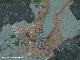
Fait partie de TeTU-Dossiers de production
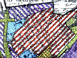
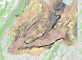
Confrontation zone villas 1952-2015 sur fond carte Siegfried 25 000.
48348 résultats avec objets numériques Afficher les résultats avec des objets numériques
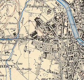
Fait partie de TeTU-Dossiers de production
Confrontation zone villas 1952-2015 sur fond carte Siegfried 25 000.
Fait partie de TeTU-Dossiers de production
nº 06 | 1929 Cadré ville de Gen., annexé à la loi du 9 mars 1929 1:25 000 (PUPG 47)
Fait partie de TeTU-Dossiers de production
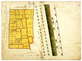
Feuilles nº 3-4

Fait partie de TeTU-Dossiers de production
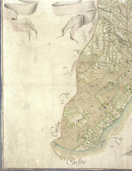
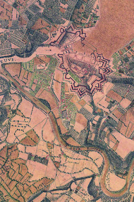
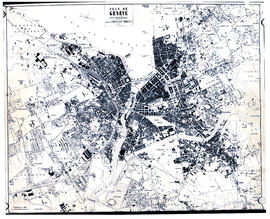
Plan de la Ville de Genève dressé par J.R. Mayer, ingénieur, publié par Briquet et fils, 1872
Fait partie de TeTU-Dossiers de production
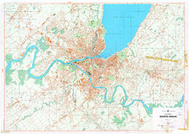
Plan officiel Genève-urbain / Département des Travaux publics ; Orell Füssli Arts graphiques. — [Échelle] 1:10000. — Genève : Service du cadastre, 1964. — 1 plan ; 86x121 cm.
Fait partie de TeTU-Dossiers de production
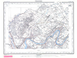
Siegfried 1898 feuille Vernier 450
Fait partie de TeTU-Dossiers de production
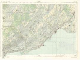
Morges, éd. 1957
Fait partie de TeTU-Dossiers de production
Coppet, éd. 1974
Fait partie de TeTU-Dossiers de production
Genève . Service du cadastre. (1982). Canton de Genève assemblage. Genève : Service du cadastre.
Fait partie de TeTU-Dossiers de production
Cadré de :
Paréjas, E. (1938). 449 Dardagny, 450 Vernier, 449bis Chancy, 450bis Bernex (Geologischer Atlas der Schweiz 1:25000 [Document cartographique] = Atlas géologique de la Suisse 1:25 000, flle nº 12). Bern: A. Francke.
Fait partie de TeTU-Dossiers de production
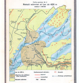
Molasse et alluvions sur le territoire genevois
Fait partie de TeTU-Dossiers de production
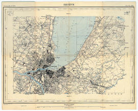
Siegfried 1916 feuille Geneve 451
Fait partie de TeTU-Dossiers de production
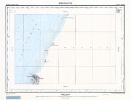
Siegfried 1913 feuille Hermance 446bis
Fait partie de TeTU-Dossiers de production
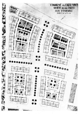
Aménagement du quartier de Montchoisy (Eaux-Vives), société des deux parcs
Braillard, Maurice
Fait partie de TeTU-Dossiers de production
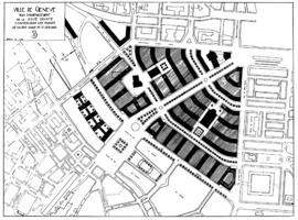
Plan d'aménagement de la rive droite conservant les églises de Notre-Dame et Saint-Gervais
Braillard, Maurice
Fait partie de TeTU-Dossiers de production
• Cadré de la Cité internationale, planche d'exposition, C.I., Archives Paul Otlet, B.I.T.
Fait partie de TeTU-Dossiers de production
Assemblage Gex (flle nº 1280) Coppet (flle nº 1281) Chancy (flle nº 1300) Genève (flle nº 1301) avec report en rouge des zones "surfaces publiques ou sites à classer" de Braillard-Bodmer 1936 (PUPG 73)
Fait partie de TeTU-Dossiers de production
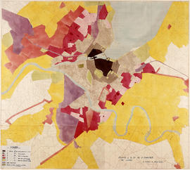
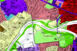
Détail du cadré la Cité nouvelle (Lancy-Onex) du plan de zones (~1960)
Fait partie de TeTU-Dossiers de production
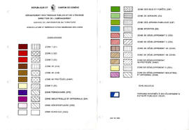
Légende du plan
Fait partie de TeTU-Dossiers de production
Cadré de la feuille nº 38
Fait partie de OBERSON Jean-Jacques
1979 E.T.S. soir architecture civil mécanique électrique
Fait partie de HEPIA archives administratives HEPIA hepiaADM
Fait partie de OBERSON Jean-Jacques
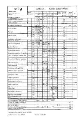
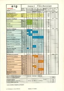
1979 E.I.G. architecture chimique civil électrique mécanique nucléaire
Fait partie de HEPIA archives administratives HEPIA hepiaADM
Fait partie de HEPIA archives administratives HEPIA hepiaADM
Fait partie de OBERSON Jean-Jacques
Fait partie de OBERSON Jean-Jacques
Fait partie de HEPIA archives administratives HEPIA hepiaADM
Fait partie de OBERSON Jean-Jacques
Fait partie de HEPIA archives administratives HEPIA hepiaADM
Fait partie de OBERSON Jean-Jacques
Fait partie de HEPIA archives administratives HEPIA hepiaADM
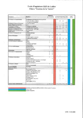
2000 Lullier E.I.L. agronomie spécialités horticoles architecture du paysage gestion de la nature
Fait partie de HEPIA archives administratives HEPIA hepiaADM
Fait partie de OBERSON Jean-Jacques
Fait partie de HEPIA archives administratives HEPIA hepiaADM
Fait partie de OBERSON Jean-Jacques
Fait partie de OBERSON Jean-Jacques
2001 Lullier E.I.L. gestion de la nature
Fait partie de HEPIA archives administratives HEPIA hepiaADM
Fait partie de HEPIA archives administratives HEPIA hepiaADM
Fait partie de OBERSON Jean-Jacques
Fait partie de TeTU-Dossiers de production
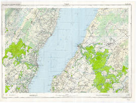
Environs de Genève, cadré nord
Fait partie de TeTU-Dossiers de production
Carte cadrée nord
Fait partie de TeTU-Dossiers de production
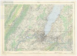
Genève, éd. 1974
Fait partie de TeTU-Dossiers de production
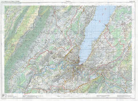
Genève, éd. 2000
Fait partie de TeTU-Dossiers de production
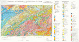
Spicher, A. August. Geologische Karte der Schweiz = Carte géologique de la Suisse / Bearb. durch das Institut für Geologie der Universität Bern und die Sektion Geologische Landesaufnahme des Bundesamtes für Wasser und Geologie = réalisation par l’Institut de géologie de l’Université de Berne et la Section Cartographie géologique de l’Office fédéral des eaux et de la géologie ; Kartogr. : Orell-Füssli-Kartographie-AG. Bern-Ittigen : Bundesamt für Wasser und Geologie 2005, Print. Accès en ligne
Fait partie de TeTU-Dossiers de production
Molasse
Fait partie de TeTU-Dossiers de production
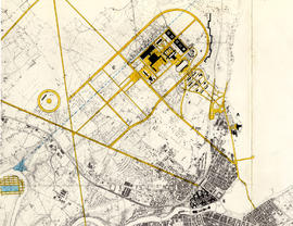
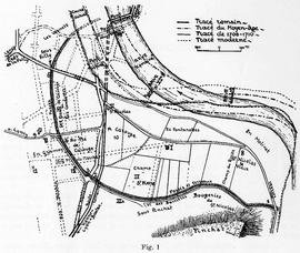
2.d Superposition tracé romain - Moyen-age - 1700 - Temps modernes
Fait partie de TeTU-Dossiers de production
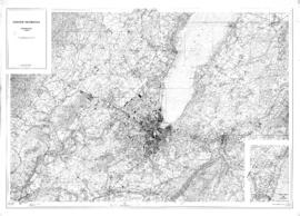
Plan de Genève / O. Messerly. — [Échelle] 1:4000. — [Genève] : Briquet & Fils, 1937. — 1 transparent ; 41,2x33,3 cm
Fait partie de TeTU-Dossiers de production
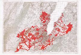
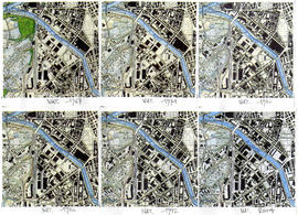
[π] Cadrés des Vernets pour les années 1967 (carte nation.), 1974 (carte nation.), 1980 (carte nation.), 1986 (carte nation.), 1992 (carte nation.), 2004 (carte nation.)
Fait partie de TeTU-Dossiers de production
Cadré du plan Siegfried, éd. 1936